Had
a wander through Albuquerque and found some interesting architecture and some
interesting places. These 2 gems are
side by side – one labelled a bug house, the other a spaceship. Lots of sculptures at the front of the
properties including a couple of guard dinosaurs.
 |
| Spaceship house |
 |
| Bug house |
 |
| These guard dinosaurs won't require much feeding |
The
giant books above The Library Bar & Grill have titles that include Lord of the Onion Rings,
Tequila Mockingbird and Gone With the Gin.
Shame it was a bit too early in the morning to go in and check them out,
although perhaps that’s a good thing. If
they have real books on the inside that would be me gone for the rest of the
day … and then some.
 |
| Some eclectic book titles atop The Library Bar & Grill |
Continued
south of Albuquerque and made our way to the Very Large Array, west of
Socorro. For those not familiar with
what the Very Large Array is (i.e. most of us), it is a series of antennae
linked in a Y configuration to make one Very Large radio telescope. This in turn picks up radio light that
creates images such as black holes and star formation. Most of the detail went right over my head
but I was impressed all the same.
 |
| 4 of the 27 antennae |
 |
| They really are quite large - two of the yellow school buses would fit end to end across the diameter |
 |
| The red VLA data is superimposed on a yellow visible light image taken from the Hubble telescope |
Just
prior to leaving Albuquerque we took a trip up Sandia Peak via the aerial
tramway. What a ride. There are only 2 towers in the 2.7 mile
journey and we climb from 6,559’ to the top of Sandia Peak at 10,378’. At one point it is over 900 feet straight
down, or if that number is too hard to comprehend – about 7 seconds. Not a trip for the faint hearted and the
views from the top are amazing.
 |
| Our carriage for the 2.7 mile journey to the top of the mountain |
 |
| Going up |
 |
| Going down |
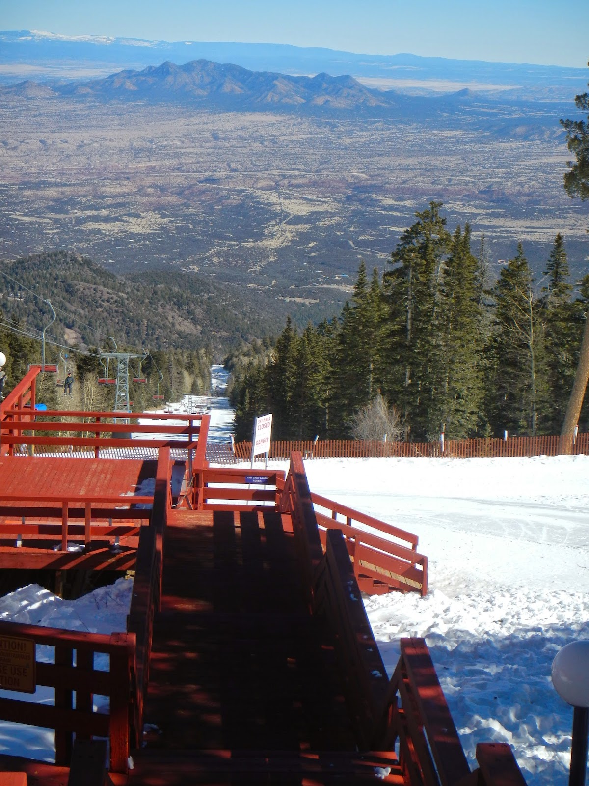 |
| At over 10,000' it's not surprising there is snow and a ski field up top |
 Couldn’t
help ourselves at Gallup – we just had to go for a short drive on The Devil’s
Highway – Route 666. It was an offshoot
of Route 66 and has subsequently been renamed Highway 491 but there is the
occasional sign to remind you of what it used to be.
Couldn’t
help ourselves at Gallup – we just had to go for a short drive on The Devil’s
Highway – Route 666. It was an offshoot
of Route 66 and has subsequently been renamed Highway 491 but there is the
occasional sign to remind you of what it used to be.
Took
a detour off our westward journeying on the I-40 and visited the Petrified
Forest National Park in Arizona. This
turned out to be another of those places where we planned to spend no more than
an hour but ended up all day. The colour
of the hills here have to be seen to be believed. Simply stunning. As far as Badlands go, this one is just as
speccy as the one in South Dakota. Never
thought I’d find a landscape devoid of trees so interesting.
 |
| Painted Desert |
 |
| The
Petrified Forest National Park was the only National Park that had
Route 66 running through it. This Studebaker and some telephone poles
are all that remain. |
 |
| Is it just me or is this petroglyph a spaceship? |
 |
| Petrified logs are strewn across the landscape |
 |
| Including giant logs like this one |
Made
our way up to Holbrook. They were smack
dab on the old Route 66 and many of the old tourist attractions are still
around, including the Wigwam Motel.
Chester Lewis, who built this one, had 6 Wigwam Villages put up, 3 of
which have survived and are still in operation.
They are far from luxurious but apparently have cable TV and air con.
 |
| Walking the world's longest map of Route 66 was thirsty work ... |
 |
| ... so, what else could we do ... |
 |
| ... when you're thirsty you're gotta drink - when you're outside a bar you may as well have a drink there |
 |
| The vintage cars add a nice touch |
Also
on Route 66 in Arizona is the town of Winslow, made famous by The Eagles with
the opening line in “Taking it Easy”. So
we did. A family donated their corner
section, the artwork went up and the tourists come in their droves.
Headed
northwards to Page. Our first visit was
to Horseshoe Bend. Another Wow!
moment. Made all the more special by no
barricades – just a sign at the start of the hiking trail pointing out the
dangers of standing too close to sandstone edges that are prone to collapse. It’s only about 1000 feet to the Colorado
River below.
 |
| No New Zealander's were harmed in the taking of this photo |
Took
the scenic drive to Zion National Park in south Utah. Sure, it added another 100 miles to the days
travel but it was so worth it. We had to
drive south from Page quite a ways before turning north once again in the
direction of the Vermillion Cliffs. 50
miles out they are impressive, more so once we were driving along the
base. The colour was so deep with the
morning sun shining on them.
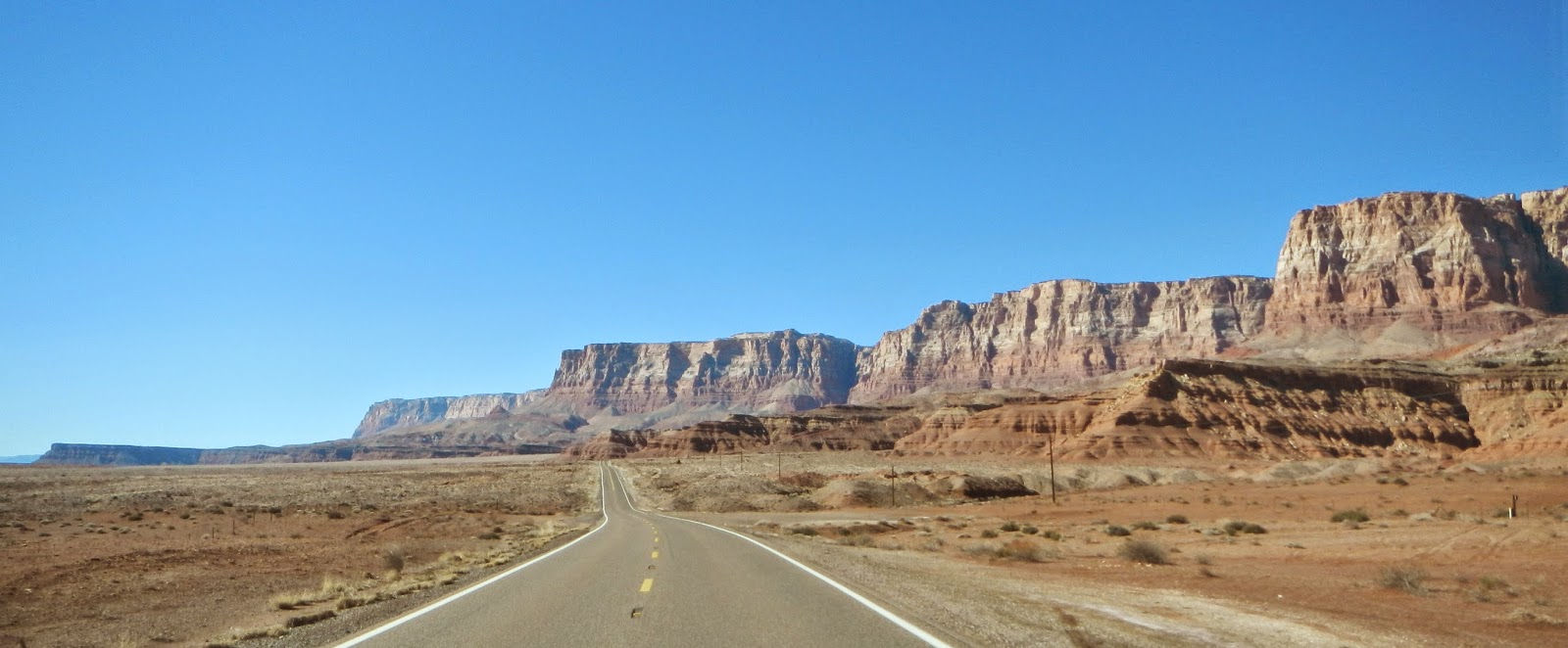 |
| Vermillion Cliffs |
 |
| Vermillion Cliffs - sadly my camera doesn't see them as well as my eyes - the red in the cliffs was much more vibrant |
Then
it was into Zion National Park itself.
Some may say it’s just a bunch of rocks.
But Wow!, what rocks. The
colours, the size, the grandeur. It also
helps that it was a lovely warm sunny winters day. It was a good thing we didn’t bring the RV
for this drive – it’s quite an exercise getting large vehicles through the
tunnel at Mt Carmel. It’s only 13’1 at
its high point and has a couple of bends in it which has caused several crashes
in the past as the large vehicles try to negotiate the bends. Nowadays there is a ranger stationed at both
ends of the tunnel who co-ordinate one way traffic when the large vehicles come
through. There is a fee involved and
they can only travel at certain times of the day.
 |
| Mt Carmel tunnel - narrow and only 13'1 in the centre |
 |
| Ventilation cuts for Mt Carmel Tunnel - shame we couldn't stop in the tunnel to take photos through them |
 |
| One of our many stops in the park |
 |
| Zion Canyon National Park |
Coming back into Page we
had to cross the Colorado River at Glen Canyon Dam. Driving across wasn’t enough so had to park
the car and walk back over.
 |
| The dam is 710' high |
 |
| Like most vistas of the Colorado River in this area, it's a long way down |


No comments:
Post a Comment